Conquer the queen of Central Bohemian Uplands – Milešovka
A popular trip to the highest mountain in the Central Bohemian Uplands - Milešovka.
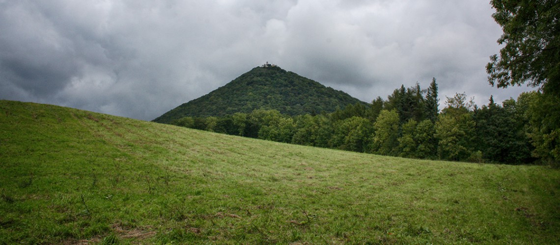
A popular tourist destination is the Milešovka hill, which is located near Velemín. Several routes can be selected for the ascent. Probably the most popular route is the one from the village of Bílka, where there is a tourist parking lot. The trip to the top is then a little over 2 km long. At the top, tourists are rightly rewarded with a unique view of the landscape of the Central Bohemian Uplands. Visitors can also use the lookout tower or have a snack in the tourist hut.
You can go to the top of Milešovka from several starting points
- from Bílka - 2.1 km along the red tourist rout (parking lot)
- from Milešov - 2.5 km along the red tourist rout (from the playground)
- from Velemín - 5 km along the blue tourist rout
- from Lovoš to Milešovka - along the blue tourist rout from top to top - 12 km
Stops
Velemín
The territory of the Velemín basin extends in the depression between the Lovoš and Milešovka massifs. The basin is actually a flat or only slightly undulating agricultural area without natural dominants, but these are richly distributed around the horizon and suitably complement the landscape of this area. The soft relief lacks any sharp shapes and completely lacks rock outcrops. The visitor will certainly be interested in several rounded ridges with grassy or bushy cover, which always exceed th
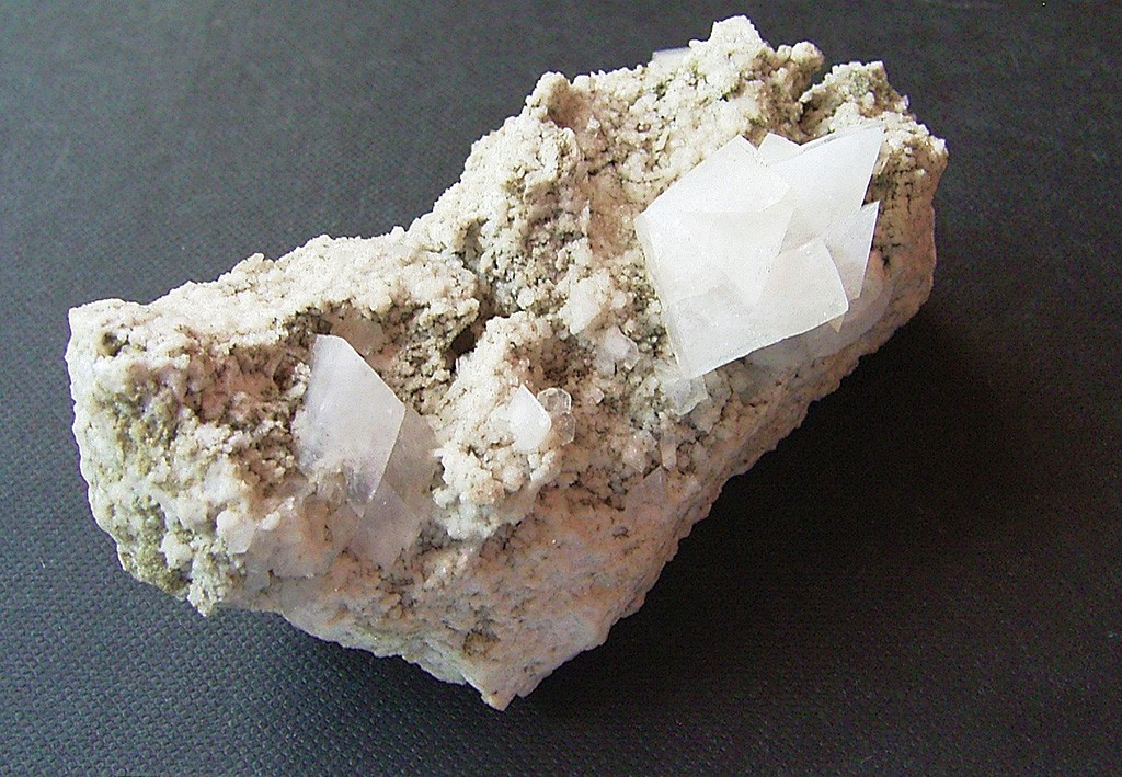
Geologically, the area of the Velemín basin is covered with layers of Quaternary sediments - fertile loess and loess clays. In the vicinity of Březno, Velemín, and Oparno, sedimentary Mesolithic rocks start to reach the surface - sandstone, sandy siltstone and siltstone. Attempts were made at Paškapole to mine a layer of black coal. Also the mineral augit is to be found in this basin.
The main watersourse of the area is the Milešovský stream, which springs on the plateau of the Březina hill at a height of 640 m and then flows through the entire Oparenské valley, to which it gives its erosive character and maintains its unique microclimate. The Milešovský stream flows below Malé Žernoseky into the river Elbe, on its left bank.
The forest cover of the basin is minimal, but visually it is surrounded by deciduous forests of the surrounding hills and massifs. Velemínsko and other features visible from the basin are very photogenic despite its crossing by the D8 motorway. The basin and its slopes are mainly agricultural land, especially large blocks of arable land and orchards. In the landscape we are able to find several orchards with old regional fruit species, or individual solitaires of fruit trees, which shine beautifully with their flowers in the spring.
In the Velemín region, the Březina Nature Trail is worth a visit, which will lead you to the repaired Military Pond and the former village of Březina, and will pass the natural monument Březina - peat bog. The landscape is dominated by Ostrý Castle on the hill of the same name. You definitely should pay a visit to the highest mountain in the Central Bohemian Uplands - Milešovka and her sister Kletečná. If you don't want to climb the hills, you can walk through the Oparenské valley and visit a different castle guarding the historically trade route. The landscape of the Velemín region is very picturesque and its character is a treasure of the Central Bohemian Uplands.
Mainstein's stone
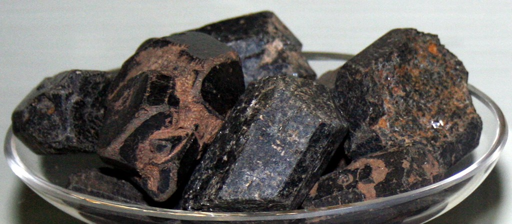
Between Bílinka and Velemín we find a slightly overgrown hill in the fields, which has witnessed a small section of the history of our and European history. There are dozens of similar hills in the Central Mountains. Ours with an altitude of 326.5 m is called "Mannstein's stone". It was named after the Prussian general Kryštof Hermann Mannstein, who took part in the Seven Years' War, which went on from 1756 to 1763. On June 27, 1757, when the wounded fled with his army to Saxony, General Mannstein gathered around this hill the circular defense of his army . The wrong construction of the wall created a gap and the Croats penetrated the defense, killing everyone. Since then, the top has been called Mannsteinberg and later named Mannstein's Stone. In the vicinity of Mannstein's stone we find in the field the mineral limonite (brownish - aqueous iron oxide) in spherical and kidney-shaped pebbles, which suggested that they are so-called "moonstones". The moonstone or adular belongs to a group of precious stones called feldspar. These precious stones are characterized by their luster in rainbow colors.
Photo Gallery
Galerie - Velemín