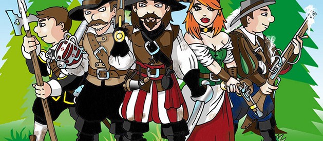
The educational journey of the robber Stetka
A nature trail around the surroundings of Štětí for the whole family, introducing the history and picturesque nature, industry and agriculture of Štetsko. The legendary robber Štětka and his four-member team are guiding the tour, giving information on a marked circuit starting from
In the old days of the Thirty Years' War, the robber Štětka was the master of the deep forests, fields and hillsides around the town of Štětí. Today, his home is the former Mordloch Cave, hidden away from people in the middle of the Stračen forests. Who knows him in the region. He protects the poor and honest, and justly punishes dishonesty and avarice. He has walked this land many times. He knows every road and footpath here.
During your adventurous journey with the robber Stetka you will come across educational boards that will tell you all about the history, nature, fauna and flora, industry and agriculture of the local region or visit the mythical cave Mordloch of the robber Stetka. You can also try out a discovery competition Following the footsteps of the robbers or robber geocaching.
Stops
Špičák
GEOMORPHOLOGY OF THE STETTIN REGION
Landscape of the Stettin region
The landscape of the Stettin region is very interesting. From the fertile valley of the Elbe region, it transitions smoothly into an undulating hilly plateau (the so-called Dokeská hilly plateau) with mixed forests and green valleys. Geologically, the whole area belongs to the Cretaceous Formation of the Mesozoic Era and the soil is loamy-clayey. The average altitude of the landscape is around 320 m above sea level, the highest altitude is 353 m above sea level at Strachal. Thanks to the very fertile soil, the traditional livelihood of the local population has been agriculture, orcharding and herding, to which a very profitable hop-growing industry was added a hundred and fifty years ago. Today, the landscape is dotted with many fields and fields of farmland with small woodland plots interspersed.
Even though a glance from the northeast gives the impression of a town surrounded by a sea of forests, there are very few of them in Štětsko. There are deciduous forests only in the Elbe floodplain, in the rolling hills to the north. In the east, mixed stands of larger or smaller wooded areas predominate. The eastern part of the area administered by the town of Štětí is part of the Kokořínsko-Máchův kraj Protected Landscape Area. It was declared in 1976 to protect the sandstone blocks that formed a dense network of canyon-like valleys in the Kokořín region.
Geology of the Stettin region
The region belongs to the Bohemian Cretaceous Basin and is built mainly by Mesozoic marine sediments. It is composed of uplifted Old-Proterozoic karst composed of chloritic phyllites, quartz keratophyre and green shales. Tertiary igneous rocks occur as vein bodies or as sope fills often penetrating chalk sediments. They consist mainly of basaltic and igneous rocks. From the older period of the Quaternary, mainly covers and fills of loess and loess clay are present. Younger Quaternary alluvium occupies only small areas along permanent watercourses.
Geologically, a large part of the Štětsko region falls under the mountain-pressure unit Ralská pahorkatina with the subunit Dokeská pahorkatina. The most extensive and central part of the Dokesská hilly plateau is the Polomené hory, which belongs to the typical sandstone hills. In its western part, the Polomené Mountains pass through the Obrtka Valley and the Brocka Upland into the more monotonous Úštěk Upland, which fills the southwest of the described area. The Polomene Mountains are roughly defined by the line Liběchov, Mšeno, Doksy, Holany, Úštěk, Chcebuz. It is divided into 7 geologically distinct parts (subdistricts), the largest of which is the Kokořínská vrchovina (Kokořínská Upland) with the highest peak Nedvězí (456 m) in the south and the Žďárská and Dubská vrchovina (Dubská Upland) adjacent to it from the north. The Polomené Mountains represent a typical sandstone hill to upland with many geomorphological attractions.
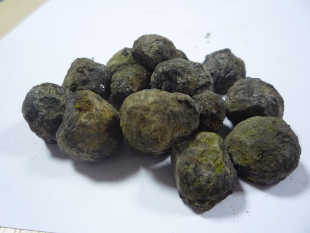
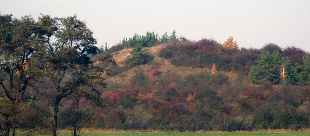
One of the attractions is the basalt hill Špičák (281 metres). An extinct volcano with a clearly visible crater, in which it is still possible to find weathered basalt balls. At the same time, this elevation can "serve" as an excellent vantage point. From its top, you can enjoy an excellent view of the town of Štětí and the landscape and hills of the Bohemian Central Highlands.
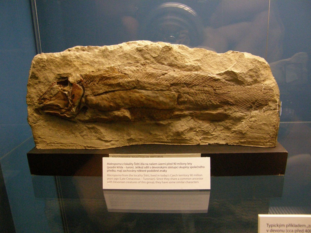
Ancestor of latimeria
One of the most famous and most remarkable marine animals is the lobe-finned fish - Latimeria chalumnae. The strange symmetrical tail fin and fleshy limbs were the first features to catch the eye of fishermen. However, they were not yet aware of its other, equally important anatomical features, which distinguish it from most other fish. However, lobe-finned fish were already very abundant in the Devonian and Cretaceous seas.
Macropoma living in the Czech Cretaceous Sea was very similar to Latimeria, although it did not grow to such a size. A relatively large number of finds come from the times of manual mining, which are preserved in the collections of the Paleontological Department of the National Museum. One of the finds also belongs to the Stettin region.
Photo Gallery
Galerie - Špičák