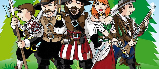
The educational journey of the robber Stetka
A nature trail around the surroundings of Štětí for the whole family, introducing the history and picturesque nature, industry and agriculture of Štetsko. The legendary robber Štětka and his four-member team are guiding the tour, giving information on a marked circuit starting from
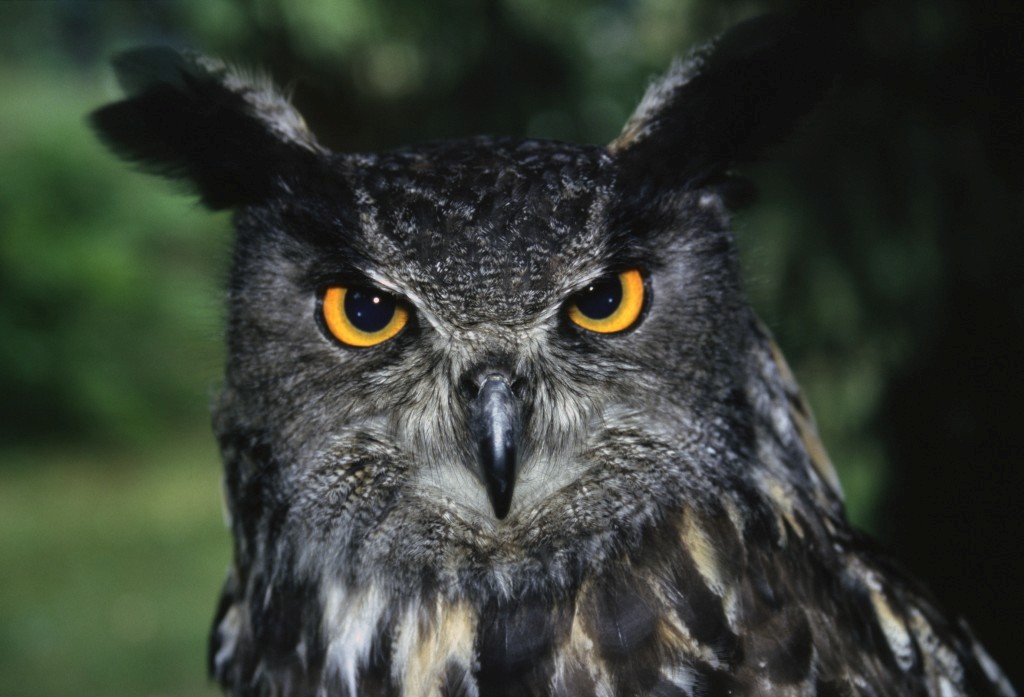
In the old days of the Thirty Years' War, the robber Štětka was the master of the deep forests, fields and hillsides around the town of Štětí. Today, his home is the former Mordloch Cave, hidden away from people in the middle of the Stračen forests. Who knows him in the region. He protects the poor and honest, and justly punishes dishonesty and avarice. He has walked this land many times. He knows every road and footpath here.
During your adventurous journey with the robber Stetka you will come across educational boards that will tell you all about the history, nature, fauna and flora, industry and agriculture of the local region or visit the mythical cave Mordloch of the robber Stetka. You can also try out a discovery competition Following the footsteps of the robbers or robber geocaching.
Stops
The Count's Chapel
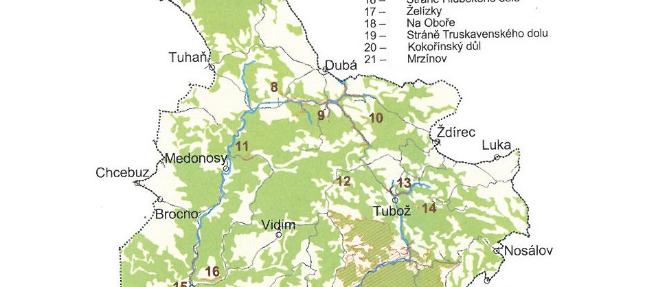
CHKO KOKOŘÍNSKO - MÁCHŮV KRAJ AND REGION ŠTĚTSKO
The Kokořínsko - Macha Region Protected Landscape Area is located on the border of the districts of Mělník, Česká Lípa and Litoměřice. The borders of Kokořínsko are closely linked to the municipalities of the Štětsko region. The border of the Kokořínsko-Máchův kraj Protected Landscape Area runs from the Central Bohemian village of Ješovice in a north-western direction along a dirt road leading to the Count's Chapel and then to the Marian Chapel in the forest complex. Here it leaves the territory of the Central Bohemian Region and passes into the Ústí nad Labem Region and the Štětska Region. It follows a forest and then a dirt road to the village of Brocno. It then follows the district road to the village of Chcebuz, where it turns northeast along local roads through the settlements of Veselí, Újezd and then along a dirt road northwards to the 339 m elevation on the Bylochov - Strachaly road.
Location of the Kokořínsko - Macha Region
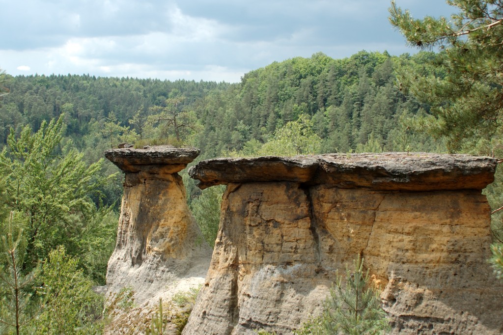
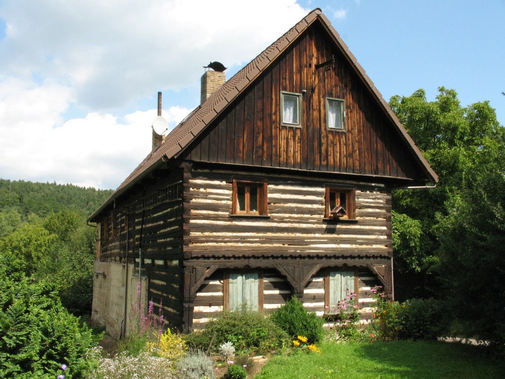
The Kokořínsko-Máchův kraj Protected Landscape Area was declared in 1976 and covers a total area of 272 km². There are 5 nature reserves and 16 natural monuments protecting the most valuable natural areas. More than half of the protected area is occupied by forests with a predominance of pine, which is a natural tree species of sandstone areas. The Liběchovka and Pšovky wetlands are of great natural scientific importance. The Kokořín region is known mainly as a picturesque landscape of sandstone rocks, and the name Mácha's Land was adopted after one of the Romantic poets. Historical settlements developed in harmony with the surrounding landscape, so that today we can find a number of architecturally unique settlements, often protected by monuments. In addition to wood (traditional timbered cottages), cut sandstone blocks - stucco - were often used for construction.
Geology and geomorphology of the Kokořín - Macha Region
The predominant rock is Mesozoic sandstone, which contains various types of cement (iron incrustations are also common), the variety of sandstone has given rise to bizarre rock formations and surface shapes (honeycombs, pseudoscrapers) are also common. Igneous rocks from the Tertiary period (gneiss, trachyte, basalt) are relatively common and form the dominant features of the whole area (Vlhošt', Velký Beškovský vrch, Housecké vrchy). In the Quaternary period, loess layers formed in places, creating fertile soils. The geomorphology is mainly characterised by deep mines, where the temperature inversion results in a reversal of vegetation zones (so-called vegetation inversion), i.e. cold-loving plant species of higher altitudes are found in the lowest parts.
Kokořínsko is an area with rich reserves of high-quality groundwater. In contrast, there are no watery surface streams, the most important being the Liběchovka and Pšova, which form a system of water areas and valley wetlands.
Vegetation and Protected Landscape Area Kokořínsko - Macha Region
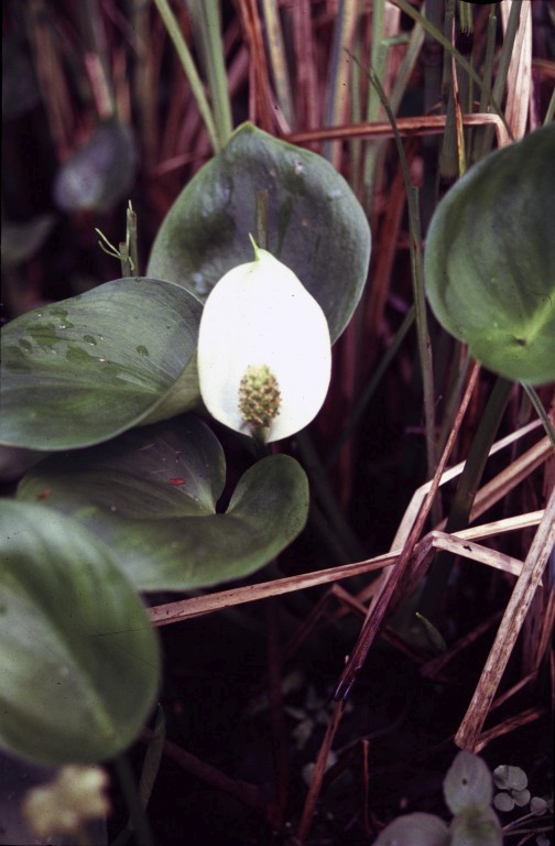
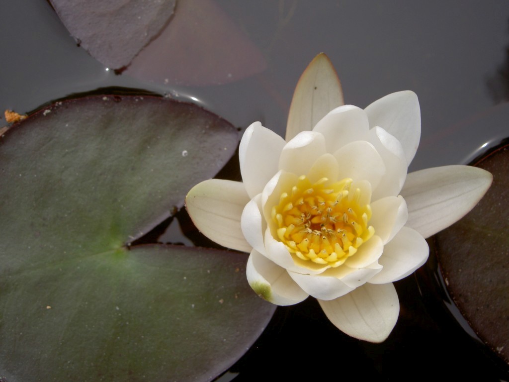
The character of the vegetation of the Kokořínsko region is greatly influenced by the presence of sandstone, which is linked to the somewhat poorer vegetation of pine forests. Species-rich habitats are those developed on calcareous sandstones, Tertiary rocks, loess and wetlands. The presence of thermophilic plant species is significant - the leafless iris, the white three-awn, the cross-leaved gentian and the meadow coneflower grow here. Among the most valuable plant species of water and wetland we can mention the white water lily, the mudwort, the spring fritillary, the three-leaved vachta, the European upolin, and orchids such as the slipper orchid, the May finger, the purple loosestrife, the mudwort.
The Kokořín region and its wetlands are a refuge for many species of amphibians (besides the common frogs, also the spotted frog and the green sundew, the common and mountain minnow and the common newt), and the occurrence of the minnow in the Pšova stream is also interesting. Rare species such as the peregrine falcon, black stork, common tit and homing pigeon nest here. The richness of the insect kingdom and spiders is gradually being discovered, as is the unique occurrence of molluscs (marsh harrier and warbler, great crested newt, river pea), which are proof of the natural preservation of their habitats.
Hiking in the Kokořín Protected Landscape Area - Macha Region
Visitors to the Kokořínsko region are recommended to use the rich network of marked hiking and cycling trails that lead through the most interesting places. Traditionally visited places include the castles of Kokořín and Houska, the rock formations of Pokličky, the viewpoint at the top of Nedvězí, but the northern part of the Protected Landscape Area with its vast forests, the ruins of Ronov Castle and the dominant feature of Vlhoště, which is the highest point of the Protected Landscape Area Kokořínsko - Mácha Region.
Photo Gallery
Galerie - Hraběcí kaple